Official site of the Tourist Office of Centre Morbihan
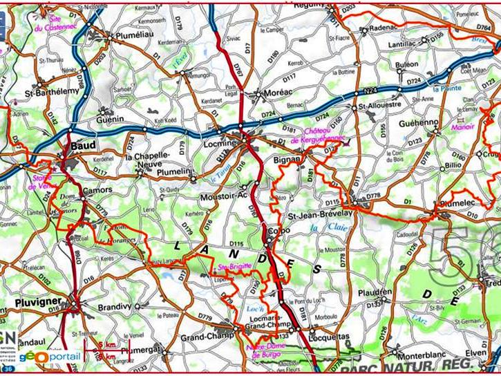
The Équibreizh from Moustoir-Ac to Guéhenno
120 km
DépartMoustoir-Ac - 56500 MOUSTOIR-AC
A voir en chemin
The Equibreizh divides two diagonals, from east to west, from Paimpont to the Black Mountains; and from north to south, from Saint-Brieuc to Josselin. To these diagonals are attached departmental and local loops. Our territory is crossed by the Josselin/Quistinic departmental route at the level of Saint-Barthélémy and Guéhenno for 120 kilometers.
The route is marked with orange plastic tags  . In general, they are to the right of the road, on trees 1.80m from the ground or on wooden poles.
| Straight away | Turn right | Turn left | |
 |
 |
 |
Local loops are connected to the Equibreizh.
In Baud, the circuit of the Landes de Kerbraz - at the locality Bourron.